Portfolio
Projects
GIS analysis, spatial research, and urban planning work across Indian cities.
Global (6 Mega-cities)
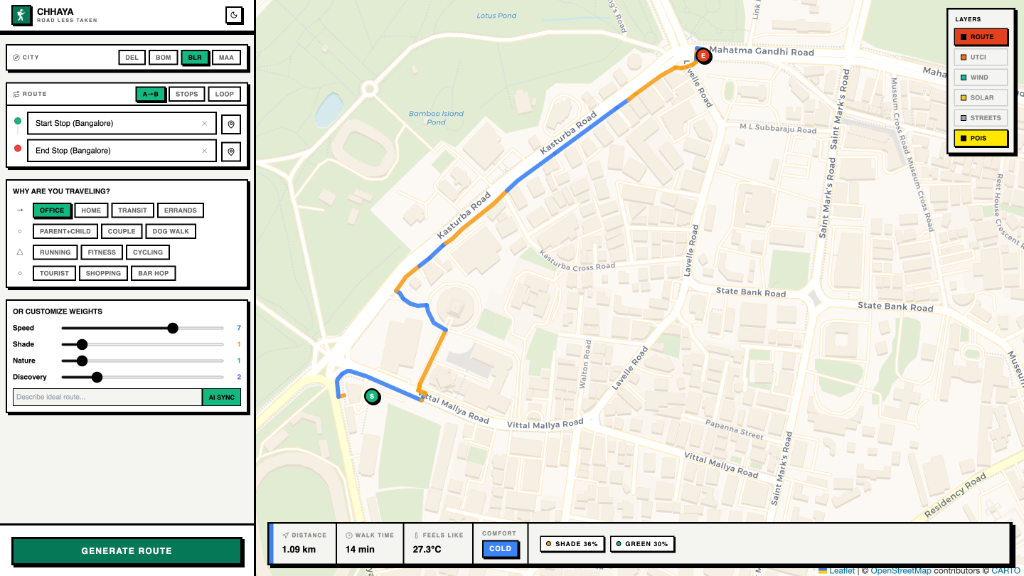
A 'Smart Google Maps for Walking' (adopted from the DETOUR project) that optimizes for human comfort and safety by calculating routes based on high-resolution microclimates, building shadows, wind tunnels, and personalized user personas.
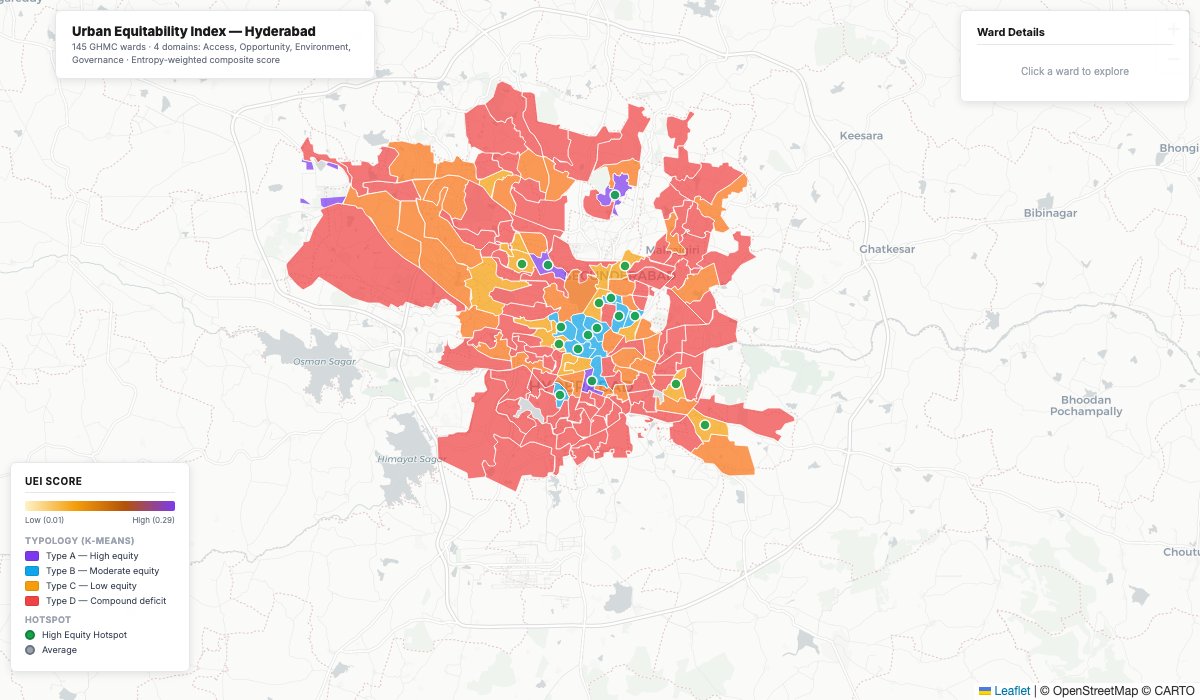
Hyderabad, Telangana
A full-stack spatial platform that scores and visualizes equity across all GHMC wards in Hyderabad — measuring access to schools, healthcare, and transit alongside opportunity, environment, and governance indicators into a single composite UEI score.
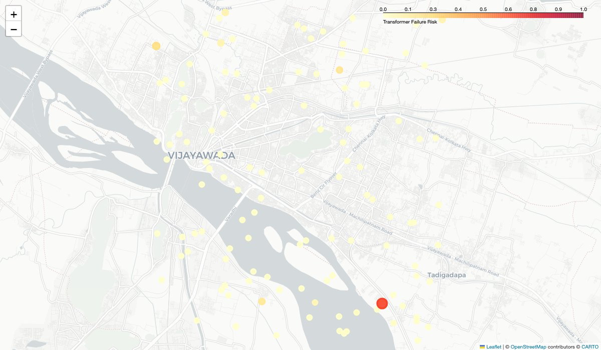
Vijayawada, Andhra Pradesh
A GeoAI platform leveraging Google Earth Engine and machine learning to assess risk across urban infrastructure assets, with an interactive web interface for spatial risk visualization.
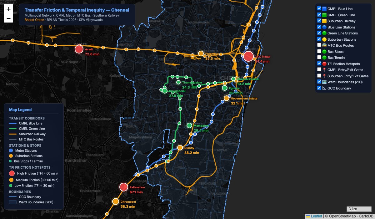
Chennai, Tamil Nadu
A thesis-driven spatial analysis of transfer friction across Chennai's multimodal transit network — mapping interchange points, quantifying Transfer Friction Index (TFI) scores, and identifying hotspots of poor connectivity.
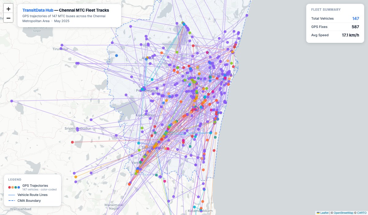
Chennai, Tamil Nadu
A modern transit data aggregation and visualization platform for Chennai's MTC bus network, serving standardized GeoJSON transit data through a performant API with an animated, interactive frontend.
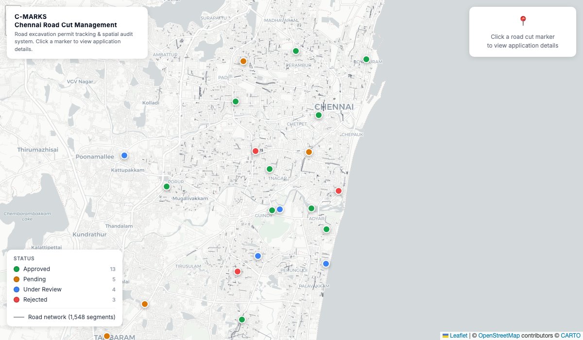
Chennai, Tamil Nadu
A full-stack civic technology platform for managing road cutting permissions and Right-of-Way (RoW) in Chennai, featuring interactive mapping, admin approval workflows, and virtual street inspection.
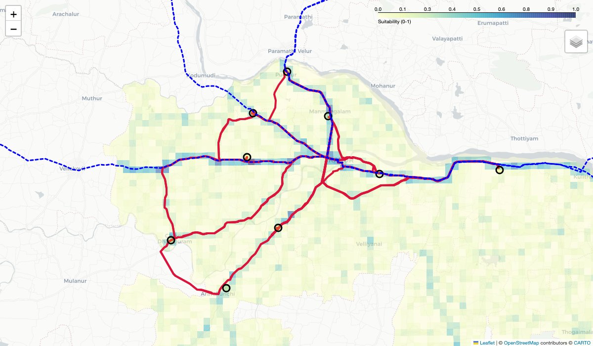
Karur, Tamil Nadu
An interactive spatial dashboard mapping logistics hub suitability across Karur district using multi-criteria composite scoring — integrating freight corridors, road proximity, depot access, and industrial density.
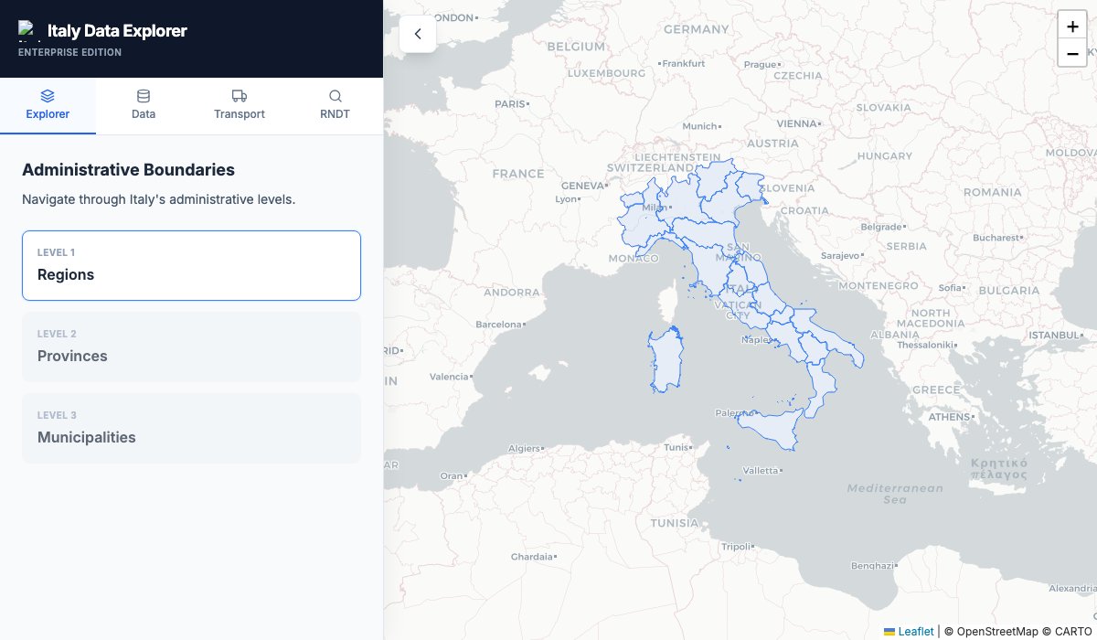
Italy
A geospatial intelligence platform for Italy integrating ISTAT statistical data, OpenStreetMap networks, and drive-time isochrone analysis to assess retail chain coverage and demographic reach.
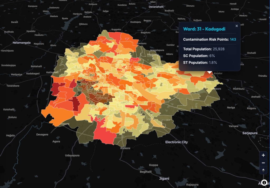
Bengaluru, Karnataka
A spatial data pipeline and dashboard scoring and mapping contamination risk across Bengaluru's water-supply and sewage infrastructure, combining citizen audits, lake water quality reports, and spatial proximity models.