
Urban Planning Portfolio
Bharat
Oraon
Urban Planning Researcher · GIS Developer · Civic Technology Fellow
Urban planning researcher working at the intersection of spatial data, governance systems, and civic technology for Indian cities.
Expertise
Focus Areas
Four intersecting domains of planning research and technical practice.
Urban Governance
Decentralisation, ULB reform, and institutional design for Indian cities.
Spatial Intelligence
GIS analysis, remote sensing, and spatial data infrastructure for planning.
Urban Mobility
Transit accessibility, street design, and sustainable transport policy.
Civic Technology
Data-driven tools and platforms for participatory urban governance.
Work
Featured Projects
Spatial analysis, GIS, and urban planning research.
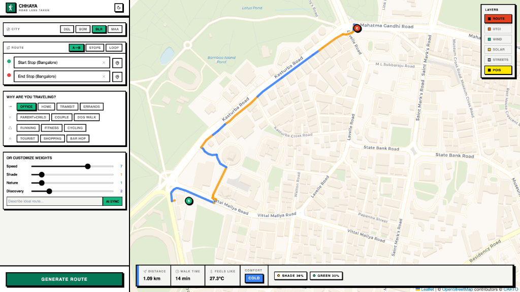
Global (6 Mega-cities)
A 'Smart Google Maps for Walking' (adopted from the DETOUR project) that optimizes for human comfort and safety by calculating routes based on high-resolution microclimates, building shadows, wind tunnels, and personalized user personas.
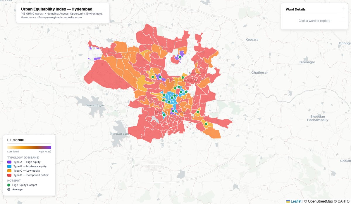
Hyderabad, Telangana
A full-stack spatial platform that scores and visualizes equity across all GHMC wards in Hyderabad — measuring access to schools, healthcare, and transit alongside opportunity, environment, and governance indicators into a single composite UEI score.
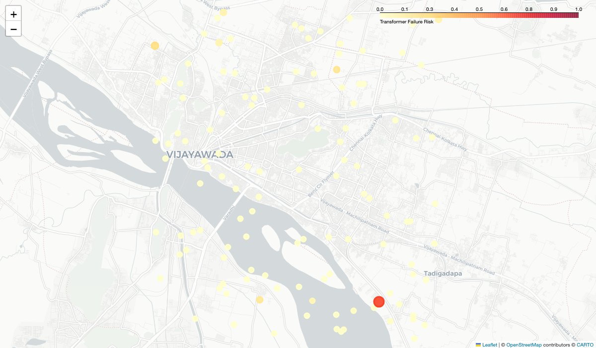
Vijayawada, Andhra Pradesh
A GeoAI platform leveraging Google Earth Engine and machine learning to assess risk across urban infrastructure assets, with an interactive web interface for spatial risk visualization.
Writing
Research Highlights
Policy essays and planning research.
Bholakpur's Warming Pulse: A Decade of Urbanization and Heat
How Ward 88 in Hyderabad heated up 1.85°C in ten years
Bholakpur Ward 88 in Hyderabad has seen median land surface temperatures rise from 40.8°C to 42.7°C between 2014 and 2024 — a 1.85°C increase — despite slight gains in vegetation. Using satellite thermal data, this piece traces how concrete expansion and densification are driving heat in one of the city's most populated neighbourhoods.
Caught in the Heat Trap: How Urban Sprawl is Reshaping Life in Hyderabad's Kondapur Ward
Thermal inequity across income lines in Ward 104
In Hyderabad's Ward 104, rapid urbanization has pushed land surface temperatures from 47.5°C to 52.5°C over a decade. Dense, lower-income pockets like Premnagar experience disproportionately higher temperatures than affluent zones — a thermal map of inequality made visible through satellite imagery.
Tracking Urban Heat in Bellandur
How Bengaluru's IT boom turned villages into heat hotspots
Bellandur in Bengaluru's Ward 150 exemplifies how rapid IT-driven urbanization transforms thermal environments. Open areas register temperatures roughly 10°C hotter than surrounding zones, while lakes and tree-covered areas still function as natural cooling refuges — a pattern that reveals how much urban heat depends on what we choose to preserve.
Let's Collaborate
Working at the intersection of cities, data, and governance.
Open to research collaborations, GIS consulting, and urban planning fellowship opportunities.
Get in touch